Nanga Parbat, Pakistan

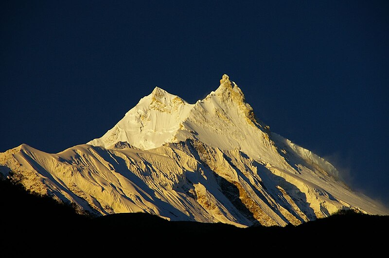
Manaslu

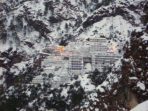
Vaishno Devi Bhawan, Darbar


Nanga Parbat, Pakistan

Manaslu

Vaishno Devi Bhawan, Darbar

Several places in the Himalaya are of religious significance in Hinduism and Buddhism. In Hinduism, the Himalaya have also been personified as the god Himavat, the father of Shiva's consort, Parvati.
The Vaishno Devi shrine near Jammu, India
Several places in the Himalaya are of religious significance in Hinduism and Buddhism. In Hinduism, the Himalaya have also been personified as the god Himavat, the father of Shiva's consort, Parvati.
The Himalayas have a profound effect on the climate of the Indian subcontinent and the Tibetan plateau. They prevent frigid, dry Arctic winds from blowing south into the subcontinent, which keeps South Asia much warmer than corresponding temperate regions in the other continents. It also forms a barrier for the monsoon winds, keeping them from traveling northwards, and causing heavy rainfall in the Terai region. The Himalayas are also believed to play an important part in the formation of Central Asian deserts such as the Taklamakan and Gobi deserts.
The mountain ranges also prevent western winter disturbances from Iran from traveling further, resulting in snow in Kashmir and rainfall for parts of Punjab and northern India. Despite being a barrier to the cold northernly winter winds, the Brahmaputra valley receives part of the frigid winds, thus lowering the temperature in the northeast Indian states and Bangladesh. These winds also cause the North East monsoon during this season for these parts.
In turn, the jet stream affects our image of Himalayan peaks. The strong stream of winds from the west pass through Everest, creating a familiar plume of snows blowing from the summit, and visible from a great distance.
Pass in Ladakh with the typical Buddhist

The Himalayan range encompasses about 15,000 glaciers, which store about 12,000 km3 of freshwater. The 70 km long Siachen Glacier at the India-Pakistan border is the second longest glacier in the world outside the polar region. Some of the other more famous glaciers include the Gangotri and Yamunotri (Uttarakhand), Nubra, Biafo and Baltoro (Karakoram region), Zemu (Sikkim) and Khumbu glaciers (Mount Everest region).
The higher regions of the Himalayas are snowbound throughout the year in spite of their proximity to the tropics, and they form the sources for several large perennial rivers, most of which combine into two large river systems:
Glaciers near by K2 in Pakistan.

This image shows the termini of the glaciers

The Himalayas are among the youngest mountain ranges on the planet. According to the modern theory of plate tectonics, their formation is a result of a continental collision or orogeny along the convergent boundary between the Indo-Australian Plate and the Eurasian Plate. This is called a fold mountain. The collision began in the Upper Cretaceous period about 70 million years ago, when the north-moving Indo-Australian Plate, moving at about 15 cm/year, collided with the Eurasian Plate. About 50 million years ago this fast moving Indo-Australian plate had completely closed the Tethys Ocean, the existence of which has been determined by sedimentary rocks settled on the ocean floor and the volcanoes that fringed its edges. Since these sediments were light, they crumpled into mountain ranges rather than sinking to the floor. The Indo-Australian plate continues to be driven horizontally below the Tibetan plateau, which forces the plateau to move upwards. The Arakan Yoma highlands in Myanmar and the Andaman and Nicobar Islands in the Bay of Bengal were also formed as a result of this collision.
The Indo-Australian plate is still moving at 67 mm/year, and over the next 10 million years it will travel about 1,500 km into Asia. About 20 mm/year of the India-Asia convergence is absorbed by thrusting along the Himalaya southern front. This leads to the Himalayas rising by about 5 mm/year, making them geologically active. The movement of the Indian plate into the Asian plate also makes this region seismically active, leading to earthquakes from time to time.


The Himalaya Range
 (Sanskrit: हिमालय, IPA pronunciation: [hɪ'mɑlijə]), or Himalayas for short, is a mountain range in Asia, separating the Indian subcontinent from the Tibetan Plateau. By extension, it is also the name of the massive mountain system which includes the Karakoram, the Hindu Kush, and a host of minor ranges extending from the Pamir Knot. The name is from Sanskrit himālaya, a tatpurusa compound meaning "the abode of snow" (from hima "snow", and ālaya "abode"; see also Himavat).[1]As words, the expression "Himalaya Range" is similar to the expression Sierra Nevada.
Together, the Himalayan mountain system is the planet's highest and home to the world's highest peaks: the Eight-thousanders, including Mount Everest and K2. To comprehend the enormous scale of this mountain range consider that Aconcagua, in the Andes, at 6,962 m, is the highest peak outside Asia, while the Himalayan system includes over 100 mountains exceeding 7,200 meters.
The Himalayan system, which includes outlying subranges, stretches across six countries: Bhutan, China, India, Nepal, Pakistan and Afghanistan. They are the source of three of the world's major river systems, the Indus, the Ganga-Brahmaputra, and the Yangtze. Approximately 1.3 billion people live in the drainage basin of the Himalayan rivers.
The range proper runs west to east, from the Indus river valley to the Brahmaputra river valley, thereby forming an arc 2,400 km long, which varies in width from 400 km in the western Kashmir-Xinjiang region to 150 km in the eastern Tibet-Arunachal Pradesh region. The Himalaya chain consists of three parallel ranges, with the northern-most range known as the Great or Inner Himalayas